Itinerary
Itinerary
Dates & Pricing
Dates & PricingTour Highlights
Tour HighlightsTablelands
Half a billion years in the making – the result of a brilliant coming together of two ancient continents -- the Earth's inner soul: the mantle - exposed to you the way few have seen it. Walk upon the Earth's Mantle - normally found far below the crust. This walk reveals earth shaking ideas that change how we understand our planet. Parks Canada guides will help you explore this bizarre and beautiful landscape, its glacial carved valleys and the unique vegetation that call the Tablelands home. This 2-hour guided walk will prepare you to better understand the world significant geology of Gros Morne as you explore the park. A landscape described as a “geologist’s dream”! Pushed in place as continents collided almost half a billion years ago, its orange weathered rock is from the middle layer of the Earth and shaped by glaciers less than 15,000 years ago.

Anchor's Aweigh
Not to be missed, the finest musical experience in Gros Morne. A blend of fun, comedy, and nostalgia - a tap your feet and clap your hands evening. A taste of Newfoundland humour without being over the top. The Anchors Aweigh Band show is a must on the list of things to do for both residents and visitors. Filled with renditions of popular Newfoundland and Labrador songs and tunes, sprinkled with one-liners and wit, and a display of culture, this very talented group of five local musicians is one of the most widely attended acts in the whole province. Visitors come from far and wide to see this performance!
Jacob A. Crocker House and Interpretation Centre
This is one of two museums in town and is a fascinating insight into a salt box house and a bygone way of life. Lots of items crammed into a small space and has a lived in, homely feel.
Bonne Bay, Kayaking
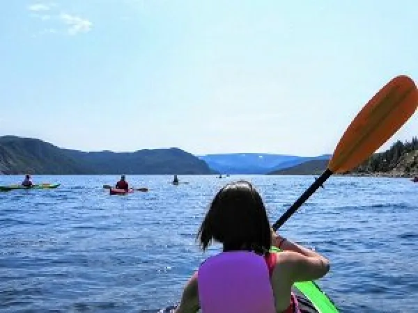
Accompanied by our Paddle Canada certified guides we first receive an introduction to kayaking and to Bonne Bay. We paddle off in the morning, in our stable sea kayaks, when the winds are typically lighter, to Xplore the coastline of this double-armed fjord. The inner bay consists of two arms, the South and East Arms, both are considered fjords with high cliffs and communities on the water's edge, with many wooded coves that provide great landing beaches. Bonne Bay is a sea kayaker’s paradise with its pristine waters, quaint coastal villages and spectacular views of the Tablelands, Gros Morne Mountain and the Long-Range Mountains. Minke whales are frequent visitors and throughout the whole paddling season you can view bald eagles, common and Arctic terns, sea stars, sea urchins, lush kelp beds and colourful seaweeds.
Kitchen Party
Like other folk traditions, Newfoundland and Labrador music first evolved as a pastime shared among friends, neighbours and co-workers. Many tunes and ballads were well known in homes and workplaces long before they were heard in more formal settings. The evolution of Celtic-based music, in particular, cannot be separated from the daily life of early settlers. Jigs and reels were played for dancing, "chin music" originated as a way to sing a tune when no instruments were available, shanties were matched to the rhythms of manual labour and ballads were, among other things, stories told to help pass long and uneventful evenings. More formal musical performances were usually reserved for church services, spiritual music having been sung and played since the first settlements were established and first churches built. Military and church bands also provided entertainment during public occasions and ceremonies.
Screech In
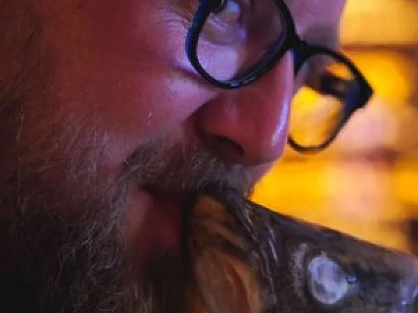
“Is ye a Screecher?” asks the master of ceremonies. You reply, “Deed I is, me old cock, and long may your big jib draw!” (You just said: “Indeed, I am, my old friend, and may there always be wind in your sails!”). This ritual, called a Screech-in, is a satirical tribute to the history of Newfoundland and Labrador. During the triangular trade, the region exchanged salted codfish, its once-primary export, for the West Indies’ rum. Later picking up the name “Screech,” the amber liquor became intertwined with local culture—one writer described the history of Newfoundland as “a long battle between rum and religion.” Today, Screech is 80-proof, locally bottled Jamaican rum, and it plays an important role in initiating visitors into Newfie culture. Screech-ins allow locals to lampoon outmoded stereotypes. Most Newfies are no longer cod fishermen, but they enjoy letting visitors in on their sense of humor, their history, and their hooch. The best way to become an honorary Newfie? Laugh at yourself. Learning to love Screech wouldn’t hurt, either. Now if you just can’t wait to be Screeched-in, you can start practicing the creed everyone recites together: “From the waters of the Avalon, to the shores of Labrador, we’ve always stuck together, with a rant and a roar. To those who’ve never been, soon they’ll understand, from coast to coast, we raise a toast, we love thee Newfoundland!
Lobster Cove head lighthouse
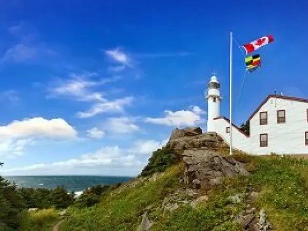
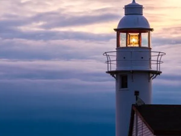
Lobster Cove Head has always been a place of gathering, refuge and celebration – a uniting force between strangers and families alike. Enjoy a cup of tea and a warm biscuit with a Parks Canada guide. Listen to the stories of the people who lived on this rugged and beautiful headland. Compliment the experience with a short self-guided walk around “the Head” and take in some of the most spectacular and picturesque views in Gros Morne National Park.
Western Brook Pond
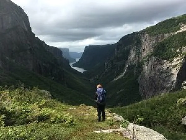
The pond, located in the long-Range Mountains, the most northern section of the Appalachian Mountains surrounded by deep rock walls. The pond is a 16 km long freshwater fjord carved out by glaciers during the ice age 25,000 to 10,000 years ago. Its water is extremely pure and reaches depths of 165 feet. Well, words and photos will never demonstrate the magnitude and beauty of the fjord, there is no better way to explore this scenic delight than by taking the Western Brook Pond Boat Tour providing live interpretation on the geological and historical features of this wonder of nature. The lake waters are pristine, having had very little impact from human activities. Vessels operating on the pond, must have special certification from Parks Canada and have minimal impact on the environment. On board, behold the spectacular glacier-carved land-locked fjord, waterfalls cascading from 2000 feet that often turn to mist before reaching the pond, billion-year-old cliffs, and frequent wildlife sightings. This special place is truly a photographer’s paradise providing stunning images waiting to be captured.
Port Au Choix National Historic Site
This National Historic Site is in the community of Port au Choix on the west coast of Newfoundland’s Great Northern Peninsula. Take in the ocean smells and experience the hospitality of this rural community. The Visitor Reception Centre explores the 6,000-year-old story of Port au Choix in an exhibit featuring a full-scale Dorset house diorama, displays of ancient tools and culture. Visiting the Maritime Archaic Peoples Sacred Burial Ground in the town of Port au Choix complements the cultural experiences in this area. Walk in the footsteps of the ancient cultures that first inhabited this spectacular landscape. Cape Bonavista to Point Riche, an area known as the French Shore, belonged to the French from 1713 until 1763, when the region was redefined as being from Cape St. John to Cape Ray. In 1904, France finally surrendered its rights to the Newfoundland shore.
Point Riche lighthouse
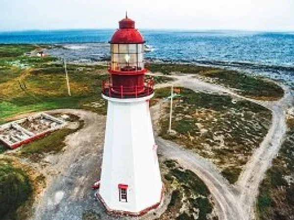
Point Riche Lighthouse, a "pepperpot" lighthouse, was built in 1892 and is still active. Located at the seaward tip of the Point Riche peninsula, the windswept station site makes up part of the outermost edge of Port au Choix National Historic Park and is a distinct landmark in the province. The first lighthouse at Point Riche, formerly part of the French Shore, was completed by the Canadian government in 1871 to assist steamers transiting the Strait of Belle Isle on their voyages between the St. Lawrence and Europe. Point Riche Lighthouse was destroyed by fire on August 15, 1890. During the summer of 1892, the present octagonal wooden lighthouse was rebuilt and is guiding passage through the Strait of Belle Isle today. Point Riche Lighthouse, a "pepperpot" lighthouse, was built in 1892 and is still active. Located at the seaward tip of the Point Riche peninsula, the windswept station site makes up part of the outermost edge of Port au Choix National Historic Park and is a distinct landmark in the province. The first lighthouse at Point Riche, formerly part of the French Shore, was completed by the Canadian government in 1871 to assist steamers transiting the Strait of Belle Isle on their voyages between the St. Lawrence and Europe. Point Riche Lighthouse was destroyed by fire on August 15, 1890. During the summer of 1892, the present octagonal wooden lighthouse was rebuilt and is guiding passage through the Strait of Belle Isle today.
Iceberg alley
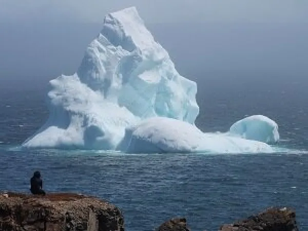
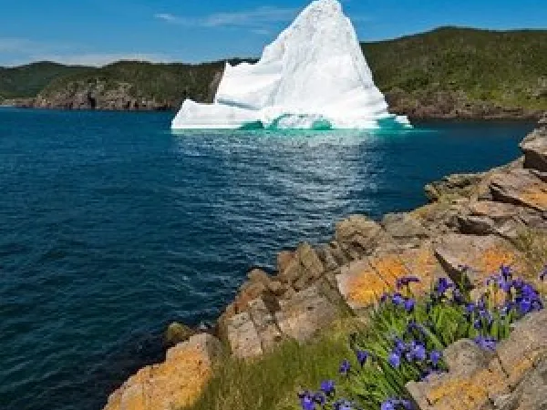
It’s estimated between 400 and 800 medium and large icebergs flow along Iceberg Alley every year. The enormous chunks of ice are approximately 10,000 years old. As for the expression “tip of the iceberg,” it comes from the fact that only about 10 percent of the iceberg is above water. All six types of icebergs can be viewed as they pass through Iceberg Alley. It was one of these icebergs that in 1912 sank the Titanic off the coast of Newfoundland. Nowadays, icebergs are monitored using satellites to track them and the local breweries use the pure water of these icebergs to make vodka, gin, rum, and beer.
Red Bay National Historic
In the 1500s, the waters of Red Bay were thick with right and bowhead whales. Whalers from the Basques regions of Spain and France established a major whale port here. On the shores of Red Bay, the Basques rendered whale oil that lit the lamps of Europe. Today, you can wander around the former whaling town and UNESCO World Heritage Site and immerse yourself in the traditional life of a Basques whaler. Take a hike along the beach and step into the interpretation centre to see an eight-metre chalupa, which whalers used on the ocean to harpoon their giant catch. To get a full appreciation for the size of these whales, compare the chalupa to the assembled collections of whalebones displayed. These showcase a time of prosperity and dangerous adventure, illustrating a long-ago way of life.
Jersey trail
Great walk starting in town, and going in either direction, you've got between 3 and 6 km of walking on a heritage trail along the seashore barrens, with interpretive signs. The trail is crushed stone, as it weaves along boulder fields, tuckamore, and grass. The trail tells the story of the early settlers, primarily those from Jersey in the Channel Islands (Islands between France and England). The destination is the archaeological dig area (the foundations of the Jersey rooms) where more interpretive signs describe the fishing rooms and the families that once inhabited them in the mid-19th century. Fortunately, local historians interviewed the elderly residents who could recall enough history about what it was like to live and work here. Certainly, the lifestyle was "all hands on deck" to prosper and live well. Above you, cliffs with a Stonehenge like feel, ancient weathered boulders and cliffs that make for interesting scenery. Wildflowers abound, at time even the whales wanted to come out and play. In days gone by, these footpaths were used to link communities and were the only way to get from one village to the next. Based on the ancient footpaths that residents and shipwreck survivors used, it's all there for today's hiker to explore.
Point Amour lighthouse
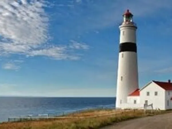
Provincial Historic Site. Imagine... you're at the top of the tallest lighthouse in Atlantic Canada, there's an iceberg, a whale breaching, and the HMS Raleigh shipwreck in the distance.... Coastal hikes, wildflowers, fossils, and the oldest burial mound in North America. Get your hiking shoes on and your camera ready. Climb to the top of the tallest lighthouse in Atlantic Canada - the second tallest in Canada! After climbing 132 steps, be rewarded with a fantastic panoramic view of the Strait of Belle Isle. Perhaps you will spot an iceberg, a whale breaching, or groups of seabirds flying along the shore. Point Amour Lighthouse is a lot more than a great view... it's a snapshot of life on the Straits, set in a spectacular landscape
Great viking feast
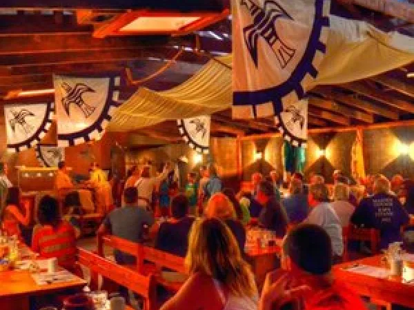
Enjoy an evening of food, fun, and feuds at the Great Viking Feast! Come to Leifsburdir and be part of a Viking court of law while feasting on an all you can eat buffet of the food that the Vikings may have enjoyed. Listen to the Vikings and customers make their case to the Lawspeaker and then decide on their fate and punishment. Join the crew and become an honorary Viking and take away a certificate to prove it.
Iceberg and whale watching boat tour
Xplore the scenic St. Anthony coast; an area that typically has more icebergs, humpbacks and dolphins then any other region in NL. Sightings of minke, fin whales and orca whales are also common. Visit nesting colonies of eider ducks, kittewakes and black guillemots. Relax in the comforts of a 50-foot vessel while being entertained by traditional music, stories and interpretation on the unique Newfoundland heritage. It’s a refreshing blend of nature, fun education and hospitality that you will never forget.
Grenfell House museum
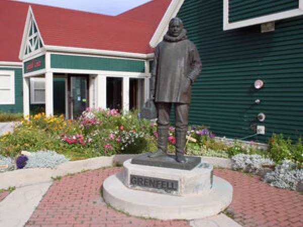
Built between 1909 and 1910 the Grenfell House was the home of Dr. Grenfell, his wife and their three children. The house has seen many changes throughout its history with rooms and chimneys being added and taken away. Originally, standing alone on the hill, the house became known as the "castle" with flower beds and vegetable gardens. Now taken over by wildflowers and shaded by trees, it offers a quiet welcome to visitors.
Jordi Bonet murals
These ceramic murals were created and fabricated by Montreal artist Jordi Bonet in 1967. One is immediately struck by the beauty and harmony of design and color. The tones of grey, blue, brown and jewel-like brilliance make the past come to life. Each of the eight murals has meaning relating to the people of Newfoundland and Labrador, their lives, or the country in which they live. These murals are part of the Grenfell Historic Properties and a must see on any stop in St. Anthony.
An evening with viking's
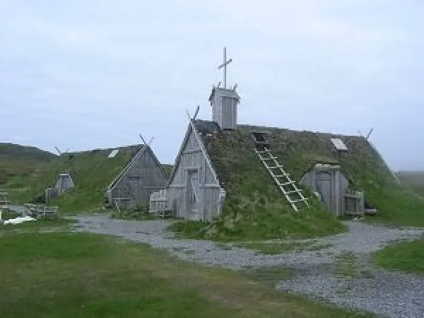
Gather around the skáli “kitchen” in one of L’Anse aux Meadows sod building’s, raise your glass with a Viking for an evening of heroic and tragic tales of Viking Sagas at the only authenticated Norse site in North America. Let the fire warm you as our Viking interpreters lead you on an expedition of adventure and exploration through storytelling. Find yourself immersed in Norse culture and provided a small taste of Vinland through story and song.
Viking Encampment. L'Anse Aux Meadows UNESCO World Heritage site
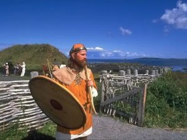
Discovery is a fearless pursuit. Certainly, this was the case when the Vikings, the first Europeans recorded to reach the new world, landed at L'Anse aux Meadows over 1,000 years ago. Curious about how the Vikings lived and worked? Visit with merchant-adventurer Finn, his wife Thora, the blacksmith Ragnar and other members of the crew to hear tales of trade, Norse society and how to turn bog iron ore into nails. Check out their weaponry, tools, cooking utensils and reproductions of many artifacts representing everyday living.
Flowers Cove, Marjorie's bridge and thrombolite walking trail
Experience the Cove located on the Great Northern Peninsula. It may seem hard to believe today, but years ago before the construction of the Viking Trail highway, Marjorie’s Bridge was the only way to get across Lawless Brook on your way up or down the coast of the Great Northern Peninsula. That is, if you weren’t walking. Today, the bridge, while was originally constructed over 100 years ago, it was lovingly restored and named after Marjorie “Burke” Myers, who is the daughter and granddaughter of the two men that originally built the bridge. The bridge connects to a walking trail from Burke’s Road to Lawless Point called the Thrombolite Trail. Staying close to the water you may catch sight of whales and icebergs going through the Strait of Belle Isle! Thrombolites are primitive life forms, bun-shaped, these unicellular critters left a good size trace of their existence in the fossil record. The trail allows you to Xplore these rare 650 million-year-old fossil structures in this picturesque setting near the top of Newfoundland’s Great Northern Peninsula. The Thrombolites are 650 million-year-old critically endangered fossil structures, resembling the earliest forms of life on earth. They were the only known forms of life on earth 3.5 billion to 650 million years ago. They’re often referred to as “living rocks,” and the only other place in the world where you can see them is Australia. You don’t need to know geology, to realize they are pretty special!
White Rocks trail
Peer into clefts eroded deep in the limestone pavement and discover plants growing in shady rock gardens.
Daniel's Harbour
Daniel's Harbour was home to Nurse Myra Bennett, one of the Northern Peninsula's most famous residents. She was once dubbed 'The Florence Nightingale of Newfoundland'. She was the only medical assistance for people living in the outport communities on the west coast for more than 50 years. Nurse Bennett's house is now a museum featuring period furniture and medical instruments.
Arches Provincial Park
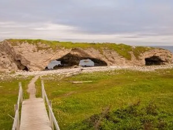
Ancient limestone carved by eons of pounding surf created the Arches, a natural rock formation known throughout the province. Take the trail leading to the huge rocks, you can walk under the Arches or on top of them and feel the awesome strength of the sea
